BirdScan MS1
Real-time protection of birds and adaptive management
BirdScan MS1 is a compact electronic scanning radar- system with the latest technology for active collision management of protected birds in conjunction with wind turbines.
The radar permanently monitors the space fully automatically in 3D and tracks and classifies large birds such as red kite, lesser spotted eagle etc. in real time.
It was developed in close cooperation with ornithological associations and wind power operators.
Coverage
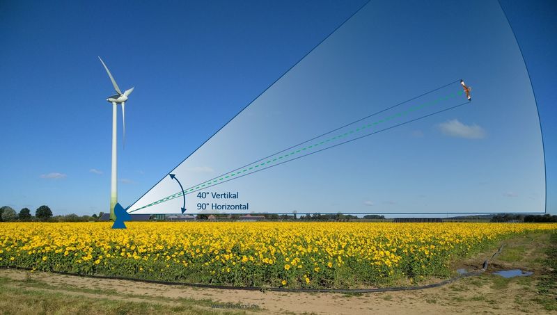
The coverage area for each antenna is a three-dimensional cone with a horizontal coverage of 90° and a vertical coverage of 40° that detects and evaluates all objects in the airspace. Using state-of-the-art electronic beamforming, BirdScan MS1 is able to monitor the entire airspace permanently and precisely and is able analyse several hundred individual targets simultaneously. If a potentially large bird is detected, the precise classification begins.
Analysis of the radar signature
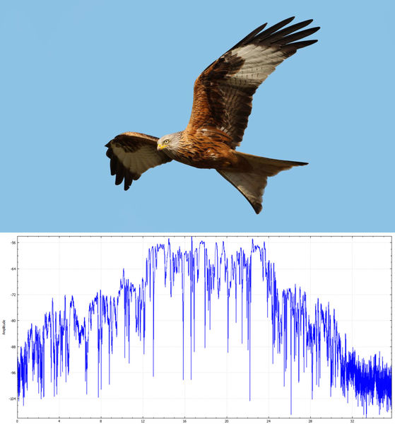
Traditional horizontally or vertically rotating radars only illuminate a target for a fraction of second and wing-flapping pattern and other parameters can not be measured. Therefore non-bird echos cannot be properly excluded. Electronic beamforming makes it possible to analyze the signatures of all objects in the airspace permanently and in real-time.
Based on the radar signature and a number of other characteristics it can be determined if it is a protected large bird.
On the right side a signature of a red kite is shown.
Integration in Wind Farms
Initial situation
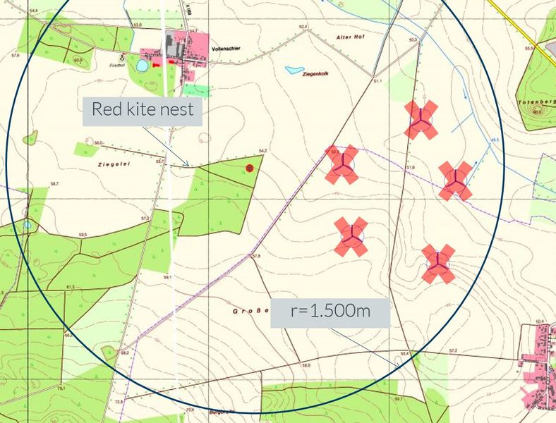
A wind farm with 5 turbines was planned. In the immediate vicinity of 500m there is a red kite nest.
The wind farm cannot be approved, as the “Helgoländer paper” requires a minimum distance of 1500m to a red kite nest.
Solution
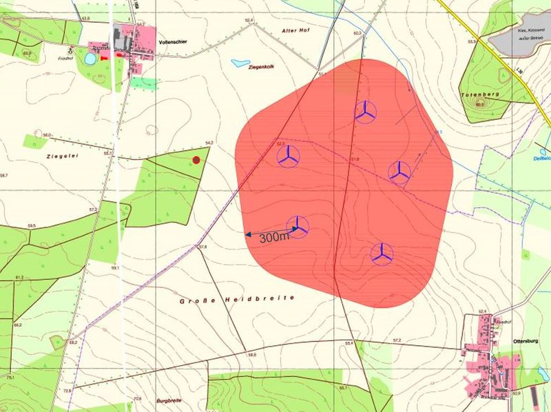
Definition of a “red zone” around the outer turbine locations.
Should a protected bird fly into the red zone, the stop signal for the wind farm is given, taking into account the direction of flight. This time is needed to stop the wind turbines.
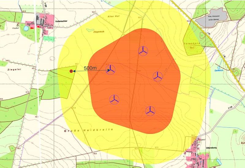
Definition of a “yellow zone” to the turbines.
All birds in this zone are constantly monitored in terms of altitude, flight speed and flight direction. This zone is also used to classify bird species to assess the potential danger to birds of prey. At present, wind farms up to 500m away from the nest are conceivable.
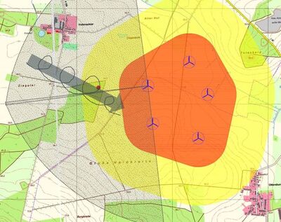
The flight routes of all birds are recorded in real time.
Hazard analysis in real- time:
– Protected bird species?
– Collision course?
– Stop signal expected?
The stop signal is triggered as soon as the bird fly into the red zone.
Process sequence
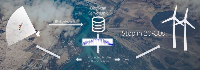
Communication to Wind Farm

Space utilisation analysis
Product Specification
| Features and functionality | Details |
| Usage | Real-time protection of birds and adaptive management |
| Sensing technology |
3D scanning Radar |
| Operating frequency | x-band tunable |
| Range (height) | 1500 m |
| Resolution | 2 m |
| Scan sector | h+/-45° per radar |
| Vertical coverage | 40° |
| Simultaneously tracks | >500 |
| Operation | automatic 24 h |
| Electrical connection | 1x230V 500W |
| Electrical communication | LAN / WAN / LTE |
| Weight | Approx. 100 kg |
| Environmental design | MIL-STD-461F, IP67, MIL-STD-810G, FCC/CE |
| Offshore kit (optional) | available |
Are you looking for a radar solution?
Tell us about your project. We are looking forward to hearing from you.
